

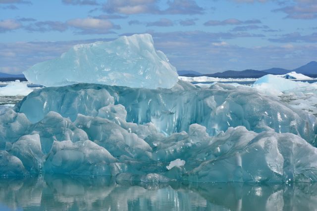

For years, Lohachara Island has been described in dramatic terms: an inhabited island swallowed by rising seas and one of the first places on Earth lost to global warming.
The real story is more complicated—and, in some ways, more important.
Lohachara, once located in the Indian Sundarbans near the mouth of the Hooghly River, disappeared after decades of erosion and environmental change. Rising sea levels are part of the broader threat facing this region, but scientists have also identified powerful local forces including river currents, sediment movement, land subsidence, cyclones, storm surges and human alterations to the delta.
That distinction matters. Climate change does not usually destroy a coastal community through one isolated mechanism. It increases pressure on places that are already physically vulnerable. Readers can find more reporting on these interconnected risks in our Climate Change section.
Nearly two decades after Lohachara became an international symbol of climate displacement, newer research shows that the wider Sundarbans is still losing land—and the underlying risks are becoming harder to ignore.
Was Lohachara Really the First Island Lost to Global Warming?
The disappearance of Lohachara attracted international attention in 2006, when reports presented it as evidence that global warming had begun permanently erasing inhabited islands.
Thousands of people had previously lived there before erosion forced residents to relocate, primarily to surrounding islands and the mainland.
But describing Lohachara as simply having been “submerged by global warming” goes beyond what the evidence supports.
India’s Ministry of Earth Sciences stated in 2010 that Lohachara, Suparibhanga and New Moore Island had experienced erosion associated with the dynamic nature of the delta rather than simply being submerged by rising sea levels. The ministry highlighted waves, storm surges, erosion and deltaic processes as important causes.
Later research has reached a similarly nuanced conclusion.
The Hooghly estuary constantly rearranges itself. Some locations lose land while sediment creates or expands land elsewhere. Researchers studying the region have linked the disappearance and erosion of islands to combinations of strong tidal currents, cyclone-generated waves, sediment characteristics, changing river dynamics and human interventions, alongside rising seas.
So Lohachara should not be treated as a simple before-and-after demonstration of global warming.
It is better understood as an early warning from a highly unstable delta where climate change is adding pressure to natural and human-driven coastal change.
What Has Changed Since the Original Lohachara Story?
This is where the story becomes more significant today.
Scientists now have decades of satellite observations that were not available when the earliest reports about disappearing Sundarbans islands were written.
A recent assessment examining the Indian Sundarbans between 1972 and 2025 analyzed 92 tidal islands. Researchers calculated an overall net land loss of about 72 square kilometers, with roughly 256 square kilometers affected by erosion while about 184 square kilometers of new land accumulated elsewhere.
The greatest instability was found along ocean-facing island margins.
Researchers linked these changes to several interacting factors, including sea-level rise, reduced sediment supply, wave activity and cyclone exposure.
That is a much more useful picture than saying the ocean simply rises until an island disappears.
The Sundarbans is effectively being reshaped from several directions at once.
Global Sea Level Is Still Rising
The broader climate signal, however, is unmistakable.
According to the World Meteorological Organization’s State of the Global Climate 2025, the years from 2015 through 2025 were the hottest 11 years in the observational record.
Global mean sea level in 2025 remained close to the record level observed in 2024 and stood roughly 11 centimeters higher than at the beginning of the satellite record in 1993. The rate of sea-level rise since 2012 has also been greater than during the earlier 1993–2011 satellite period.
Global warming raises sea level mainly because warmer ocean water expands and land-based glaciers and ice sheets lose mass.
For a large coastal city protected by extensive infrastructure, a few millimeters of additional water each year can sound minor.
For a low-lying delta repeatedly hit by tides, cyclones, erosion and saltwater intrusion, those millimeters accumulate on top of existing problems.
That is why global averages tell only part of the story.
The Bigger Problem Is Relative Sea-Level Rise
People living along the Sundarbans do not experience “global mean sea level.” They experience the water level relative to the land underneath their homes.
If sea level rises while the land is simultaneously sinking, the practical effect becomes greater.
A 2026 study of the Indian Sundarbans used satellite radar observations and modeling to examine land subsidence, flooding and relative sea-level rise. Researchers found that subsidence is an important contributor to future coastal vulnerability and warned that even moderate sinking can produce serious consequences in such a low-elevation delta.
The Intergovernmental Panel on Climate Change has made the same broader point about vulnerable coastlines. Sea-level rise interacts with erosion, flooding, land subsidence, storms, settlement patterns and changes in sediment supply. In some places, those local factors can alter coastlines faster than rising seas alone.
That helps explain why assigning the disappearance of one island entirely to global warming is scientifically difficult.
It also explains why climate change remains extremely important.
Global warming raises the baseline on which all these local pressures operate.
Ghoramara Shows the Human Cost More Clearly
Lohachara has largely become a historical case. Nearby Ghoramara Island offers a clearer view of what ongoing coastal loss means for people today.
A study using satellite observations from 1990 through 2020 found that Ghoramara’s area declined from about 608 hectares to 375 hectares.
That represents a land loss of roughly 39% in three decades. Researchers documented major losses of agricultural land, vegetation and built-up areas alongside continuing shoreline movement.
For residents, coastal erosion is not an abstract climate statistic.
A disappearing shoreline can mean losing farmland first, then freshwater access, roads, schools and eventually homes.
Families may relocate within an island before leaving completely. Others move to neighboring islands that face environmental pressures of their own.
This is why the phrase “climate refugee,” while powerful, does not always capture the full experience. Migration can happen gradually over many years instead of following a single dramatic disaster.
Lohachara’s former residents experienced exactly that kind of long-term displacement.
Bangladesh Faces the Same Delta From the Other Side
The Sundarbans does not end at India’s border.
The mangrove ecosystem stretches across India and Bangladesh, while the larger Ganges-Brahmaputra-Meghna delta supports tens of millions of people.
Research published in 2025 examined several decades of temperature, sea-level and shoreline data across 10 coastal districts of Bangladesh. The study found rising temperature and sea-level trends while documenting continuing erosion and accretion along different parts of the coastline.
That last point is important.
Bangladesh’s coastline is not uniformly retreating. Deltas naturally move sediment, meaning one location can gain land while another loses it.
The danger comes from the combination of changing sea level, erosion, subsidence, cyclones, salinity and dense settlement.
That creates a much more complicated challenge than maps showing a fixed amount of Bangladesh simply disappearing beneath a future sea level.
Mangroves Are Part of the Defense
The Sundarbans is also the world’s largest mangrove ecosystem, and its future matters far beyond individual islands.
Mangrove forests can reduce wave energy, stabilize sediment and provide natural protection to coastal communities. They also support fisheries, wildlife and local livelihoods.
Yet the mangroves themselves are exposed to rising seas and erosion.
Modeling published in 2023 estimated that the Indian Sundarbans could experience major mangrove losses by 2100 under different sea-level-rise scenarios if present management continues. Depending on the scenario, researchers projected losses ranging from 42% to 80% of the existing mangrove area.
The study also found that allowing mangroves greater room to migrate inland could reduce some losses, although doing so would create difficult trade-offs because people currently use much of that land.
This gets to the heart of the Sundarbans problem.
Protecting communities, farmland and mangrove habitat cannot be treated as separate issues.
Global Warming Is a Risk Multiplier, Not a Single Cause
The updated science changes the way Lohachara’s story should be told.
It would be inaccurate to say:
Global warming raised the ocean and directly drowned Lohachara Island.
The evidence supports a more defensible conclusion:
Lohachara disappeared within a highly dynamic delta affected by severe erosion, changing sediment flows, tides, storms and other processes. Human-caused sea-level rise now adds another growing source of pressure to the same region.
This might sound less dramatic, but it is more useful.
Climate change frequently works as a risk multiplier.
A cyclone occurring on top of higher sea levels can produce a greater storm surge.
A coastline already experiencing erosion has less land available to absorb another extreme event.
Saltwater can penetrate farther inland.
Subsiding ground increases relative sea-level rise.
Damaged mangroves reduce natural coastal protection.
Families already living close to the economic margin have fewer resources available to rebuild or relocate.
The individual processes overlap until environmental change becomes a social and economic crisis.
What Can Vulnerable Coastal Communities Do?
There is no single adaptation strategy that works everywhere.
Some populated areas can be protected through stronger embankments, improved drainage, elevated infrastructure and better cyclone preparedness. In other locations, restoring mangroves and allowing coastal ecosystems more room to move can provide additional protection.
Freshwater security also matters. Saltwater intrusion can damage drinking-water sources and farmland long before permanent inundation makes an area uninhabitable.
In the most exposed locations, governments may eventually have to consider planned relocation rather than repeatedly rebuilding communities in places where the coastline is steadily retreating.
These decisions are increasingly part of international climate negotiations. Our analysis of what happened at COP30 looks at the continuing debate over adaptation, climate finance and the resources vulnerable countries need to prepare for worsening climate impacts.
The challenge is not only reducing future emissions. Communities already experiencing sea-level rise, erosion and extreme weather need practical adaptation measures now.
Lohachara Was a Warning. The Story Did Not End There
Calling Lohachara the world’s “first victim of global warming” makes for a memorable headline, but the science is more complicated than that description suggests.
The stronger lesson is what happened afterward.
Since Lohachara disappeared, satellite records have documented continuing erosion across parts of the Sundarbans. Ghoramara has lost substantial land. Sea levels have continued rising globally. Researchers are documenting subsidence, changing sediment patterns and growing coastal exposure across both India and Bangladesh.
Meanwhile, global sea level is now roughly 11 centimeters higher than it was when satellite measurements began in 1993.
That changes the question.
Instead of asking which island qualifies as the first victim of global warming, the more important question is how many vulnerable communities can avoid becoming the next ones.
The answer will depend on stronger coastal defenses where appropriate, protection and restoration of mangroves, better sediment and river management, reliable cyclone warnings, safer housing, freshwater protection and realistic plans for communities where permanent relocation eventually becomes unavoidable.
Lohachara’s history should therefore be treated neither as a climate myth nor as proof that every coastal island will disappear.
It is something more useful: a warning of what happens when rising global temperatures meet a fragile coastline and communities with very little room to retreat.


Leave a Comment